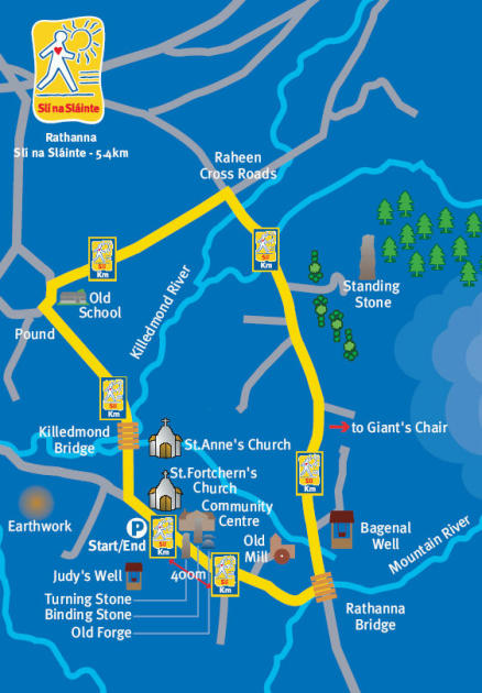
Rathanna Slí na Sláinte -
5.4km
Slí na Sláinte stands for 'path to health'.
The Rathanna Slí na Sláinte is
5.4km in length and affords
spectacular views over Mount
Leinster and the surrounding
countryside of County Carlow.
The route starts at the car park
opposite the Community Centre
and continues towards St.
Fortchern's Church turning right
at Moyvalley, and on towards
Killedmond Bridge. The route
continues, turning right past the
Old School and then immediately
right again, along a pleasant
country road. Turning right at
Raheen Cross Roads, follow the
route for nearly 2km following the
road just under Mount Leinster.
Keep a look out along this road
for sightings of Whitethroats
and Willow Warblers darting
along the hedgerows. Watch out
for Stitchwort, Ox-eye Daisies and
Ragged Robin flowering in the
ditches.
Turning right at Rathanna Bridge,
continue back towards the starting
point at the car park.
Recommended as a daytime walk and
can be walked in either direction
This Walk is supported by
Carlow County Council |
 |